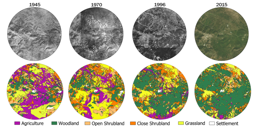
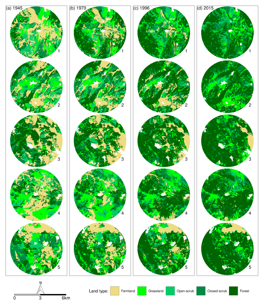
In order to reveal the effects of land use change on diversity patterns, detailed mapping of land cover was conducted for four periods, namely years 1945, 1970, 1996 and 2015. The imagery data employed for this purpose included orthorectified aerial photos taken in 1945 (source: Hellenic Cadastre), 1996 (source: Ministry of Rural Development and Food of the Hellenic Republic) and 2015 (source: Hellenic Cadastre) as well as 1970 aerial photographs (source: Hellenic Military Geographical Service). The latter required orthorectification which was accomplished via employment of a digital elevation model (DEM) of 5 m resolution (source: Hellenic Cadastre) and the images of 2015 as primary reference data, while images of 1945 and 1996 were used as secondary reference data.

The mapping of land cover was accomplished through manual interpretation of the aerial orthophotos and vectorization of the boundaries of all patches with different vegetation cover rates. Specifically, four land type categories were distinguished during mapping, namely grassland, open-scrub, closed-scrub and forest, corresponding to a tree layer cover of 0-10%, 10-40%, 40-70% and 70-100% respectively. In addition, areas with evidence of agriculture and land management practices were identified as farmlands. The aforementioned classification was selected as it was considered capable of capturing major changes among successional stages of vegetation. The area of 250 m2 was selected as the threshold for the minimum polygon area during vectorization, in order to reassure that the mapped patches have area greater than the maximum area of vegetation plots. Area of human settlements was also distinguished and excluded from further analysis. Finally, four maps of land cover were created, one for each study year (1945, 1970, 1996 and 2015).

